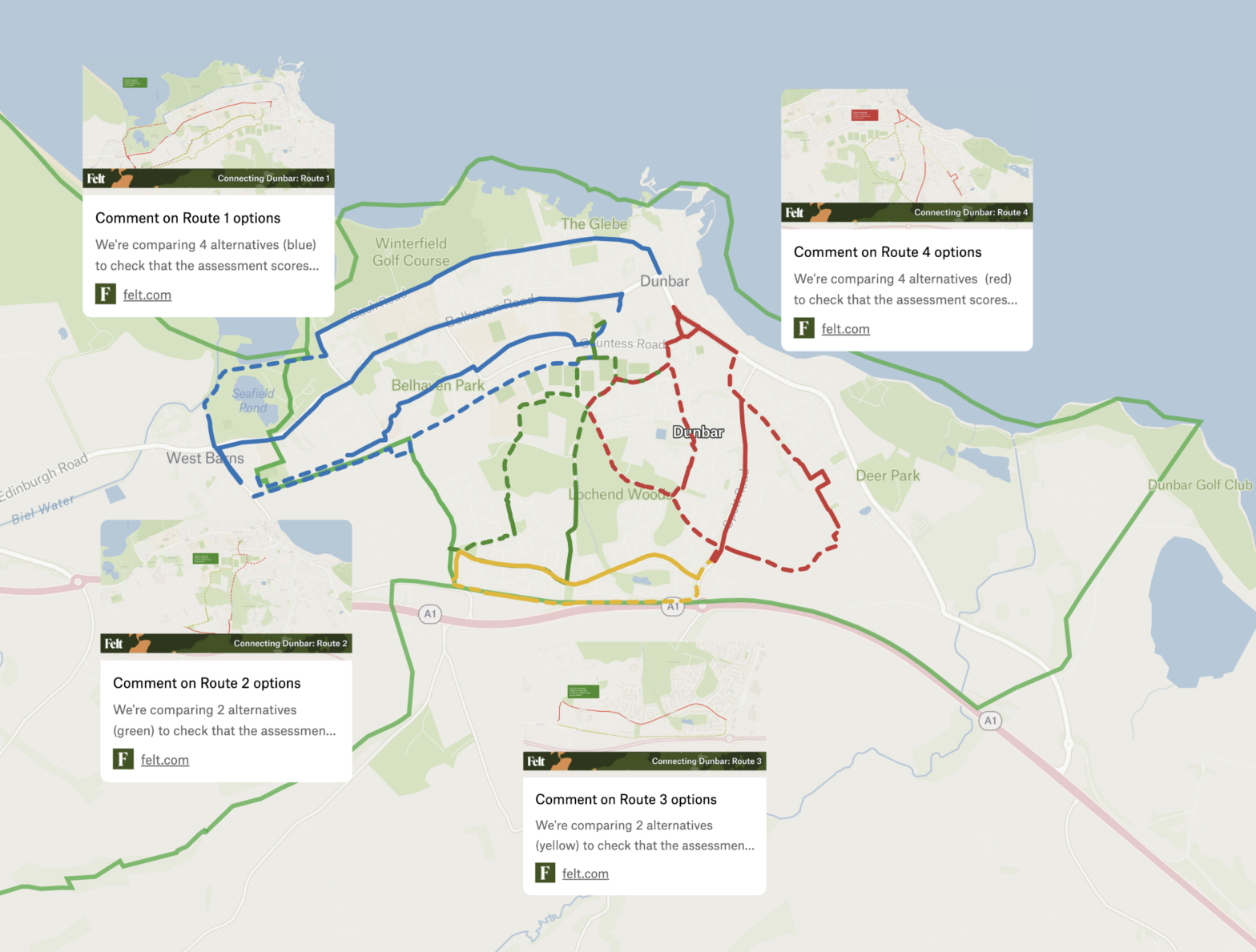
The interactive map below shows each of the 4 route options being considered and appraised.
Note, that the route option exercise is designed to find a more optimal route, either quicker and more direct or safer, or just more attractive and comfortable, taking into account factors such as equalities legislation and deliverability.
The interactive map collates the options into a single map to show the full coverage, which in turn leads to each of the 4 main routes. You need to click through to each option if you want to add a comment.
We’re interested in your reactions to the initial scoring and whether you agree with our the preferred options so far.
In the next phase (stage 2) we will investigate further only the preferred options and generate concept designs (engineering drawings), more detailed costings, signage proposals, and other measures: e.g. mitigations to improve the environment.
At each stage there will be further opportunities to feed into the process.
Comment on individual route options
If you want to take a deep dive into the evaluation of each option we’ve wrapped up the presentations above into a static pdf document, which compares each route option, in summary and in detail, side by side against the standard design criteria.