
We’ve been busy developing route options, designed to meet a significant number of routine journeys in the main directions (West – East and also South North) to trip generators and along obvious desire lines, while avoiding heavily trafficked main roads.
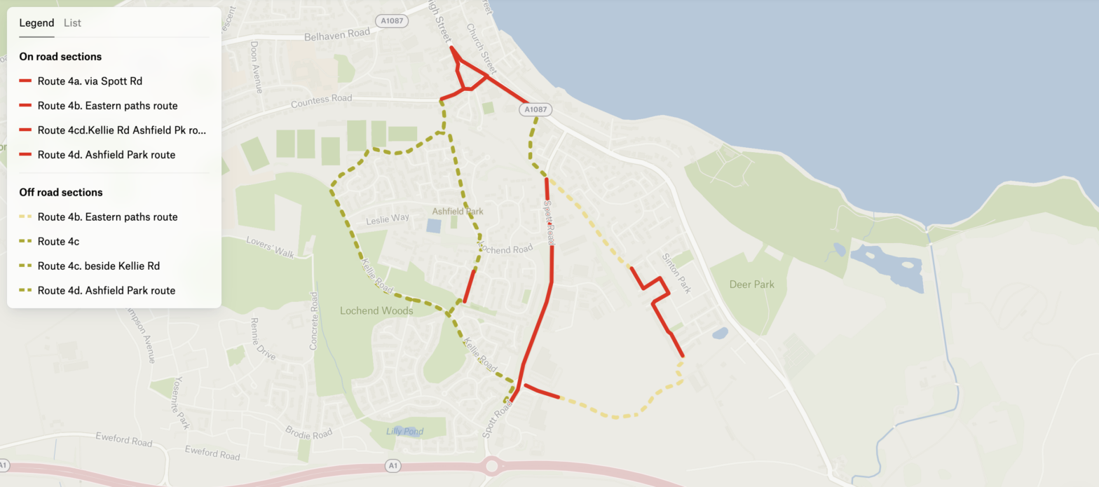
Here’s the final proposal from the retail park to the town centre, using the verge of Kellie Rd to achieve a higher degree of segregation from traffic, while using existing paths, and traffic calmed areas.
We’ve opened comments so you can leave a specific comment or general ones on the options appraised and the aggregate scores:
Summary appraisal
| 4a. Spott Rd | 4b. Eastern paths route | 4c. New path beside Kellie Rd | 4d. Ashfield Park route with new and existing paths | |
| From | Retail park entrances | Retail park entrances | Retail park entrances | Retail park entrances |
| Via | Spott Road (on road for cycles), and thence via existing path towards cemetry, Queens Rd, Abbey Road | East on existing good shared use path via rail underbridge to Dempster Place, Comrie Avenue, Manderson Drive, and existing good shared use path to Spott Rd crossing, and thence via existing path towards cemetry, Queens Rd, Abbey Road | via improved shared use pavement to Kellie Rd roundabout, then widened shared use path in southern verge of Kellie Rd to sports fields, and either north to Countess Crescent crossing, OR northeast to station underpass, Countess Rd, Abbey Rd | via improved shared use pavement to Kellie Rd roundabout, then widened shared use path in southern verge of Kellie Rd to new link path to Brunt Court, existing path to Ashfield Park, existing path to Station underpass, Countess Rd, Abbey Rd. This route also provide links on existing paths to Spott Rd Industrial Estates. |
| To | High Street | High Street | Bleachingfield Ctr/ High St | High Street |
| Option score | 3 | 8 | 18 | 17 |
We look at the following criteria to evaluate the options. We score each criterion on a scale -3 to +3. The highest theoretical score possible is 27. The lowest -27.
Evaluation Criteria
| Safety |
| Design should minimise the potential for actual and perceived risk of accidents for all users. |
| Directness |
| Design should be as direct as possible and minimise detours and delays. The impact of junctions and crossings on journey times should be considered. |
| Coherence |
| Design should be continuous and consistent from origin to destination. |
| Comfort |
| Design should meet surface width, quality and gradient standards and be convenient by avoiding complex manoeuvres. |
| Attractiveness |
| Design should complement and enhance its environment in such a way that cycling is attractive. |
| Adaptability |
| Design should consider the potential for future expansion and cater for an anticipated rise in the number of people cycling. |
| Accessibility |
| Design should comply with the Equality Act 2010 and cater for all types of bike |
| Socio-economic |
| Local businesses should benefit |
| Deliverability |
| Constraints and objections should be overcome in delivery timeframe. |